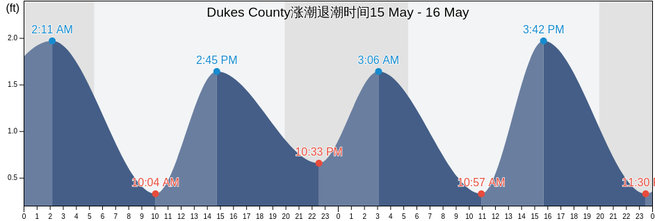
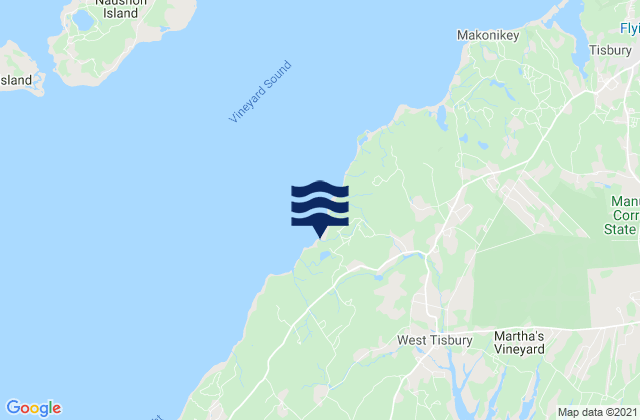
Dukes County, Massachusetts, United States涨潮退潮时间

星期五 26 四月 2024, 01:49 EDT (GMT -0400). 目前这股潮汐正在下降Dukes County正如您在潮汐图中看到的,最高潮2.62ft在22:50和最低潮0ft在05:12 单击此处查看本周Dukes County的潮汐时间.

下一个涨潮

下一个涨潮是在
10:31

下一个退潮

下一个退潮是在
05:12

Dukes County潮汐表

Dukes County涨潮退潮潮时间
Dukes County潮汐表 日出和日落
第一潮水 第二次潮水 第三潮水 第四潮水
周五 2605:12
0 ft
10:31
1.97 ft
16:18
0.33 ft
22:50
2.62 ft
05:46 19:36
周六 2705:46
0.33 ft
11:14
1.97 ft
16:36
0.33 ft
23:35
2.3 ft
05:45 19:37
周日 2806:25
0.33 ft
12:01
1.97 ft
17:10
0.33 ft
05:44 19:38
周一 2900:24
2.3 ft
07:21
0.33 ft
12:54
1.97 ft
18:03
0.33 ft
05:42 19:40
周二 3001:18
2.3 ft
08:37
0.33 ft
13:52
1.97 ft
20:11
0.66 ft
05:41 19:41
周三 102:19
2.3 ft
09:48
0.33 ft
14:55
1.97 ft
22:09
0.33 ft
05:40 19:42
周四 203:23
2.3 ft
10:50
0.33 ft
15:59
1.97 ft
23:19
0.33 ft
05:38 19:43

Dukes County今天去钓鱼的最佳时机 普通捕鱼日

主要捕鱼时间

从09:19至11:19

经过月亮反面 (月亮下)

从21:53至23:53

月亮经过 (月亮上)

小渔时间

从06:23至07:23

月落

从22:23至23:23

月初

单击此处查看本周Dukes County的钓鱼时间.

Dukes County当前天气

局部多云

天气

云盖4%
温度

温度

41°F
最低限度40°F/最大限度45°F
风

3英里/小时
风阵4英里/小时
湿度

湿度

62%
露点29°F

单击此处查看Dukes County的本周天气

今天Dukes County的天气

太阳升起的时间会是05:46和太阳落下的时间会是19:36。这里将有13小时和50分钟的阳光时间和平均温度是43°F。目前的水温是46°F和平均水温是46°F.
Dukes County今天的天气
0 h 3 h 6 h 9 h 12 h 15 h 18 h 21 h 24 h
局部多云局部多云局部多云局部多云局部多云局部多云局部多云局部多云局部多云
41°F44°F42°F44°F41°F44°F42°F44°F45°F

单击此处查看Dukes County的本周天气

更多Dukes County的潮汐和海洋信息

地区和城市内Dukes County, Massachusetts, United States

Abels HillHedge Fence-LHommedieu Shoal betweenPenikese Island 0.8 mile northwest of
Bend-in-the-Road BeachJuniper PointQuick's Hole
Bristol BeachKatama BayQuicks Hole
Canapitsit ChannelKettle CoveQuicks Hole (middle)
Cape Poge Light 1.4 miles west ofL'Hommedieu ShoalQuicks Hole North side
Cape Poge Lt. 1.7 miles SSE ofLamberts CoveRaymond Street
Cape Poge Lt. 3.2 miles northeast ofLHommedieu Shoal north of west endRobinsons Hole 1.2 miles southeast of
Cedar Tree NeckLighthouse BeachRobinsons Hole Nashuon Point
Chappaquoit BeachLittle HarborRound Hill Point
Chappaquoit PointLobsterville BeachSouth Beach State Park
Chappaquoit Point West Falmouth HarborLong PointSouth Cape Beach
Clarks PointLucy Vincent BeachSquibnocket Beach
Cleveland LedgeMartha's Vineyard GPS BuoySquibnocket Point
CuttyhunkMarthas Vineyard GPS BuoySurf Drive Beach
Cuttyhunk Pond entranceMenauhant BeachTarpaulin Cove 1.5 miles east of
Dumpling Rocks 0.2 mile southeast ofMenemsha BeachUncatena Island (South Side)
East BeachMenemsha BightVineyard Haven
East Chop 1 mile north ofMenemsha Harbor MaVineyard Haven Harbor
East Chop-Squash MeadowMuskeget ChannelWaquoit Bay entrance
East Chop-Squash Meadow betweenMuskeget Rock 1.3 miles southwest ofWasque Point (Chappaquiddick Island)
EdgartownNo Man's LandWasque Point Chappaquiddick Island
Edgartown Great PondNobska Point 1 mile southeast ofWeepecket Island south of
Falmouth HeightsNobska Point 1.8 miles east ofWest Chop 0.2 mile west of
Falmouth Heights BeachNomans LandWest Chop 0.8 mile north of
Felix NeckNorton Point 0.5 mile north ofWest Falmouth Harbor
Fuller StreetNorton Point BeachWest Island (west side)
Gay HeadOak BluffsWest Island 1 mile Southeast of
Gay Head 1.5 miles northwest ofOceanographic InstitutionWest Tisbury
Gay Head 3 miles north ofOff Chilmark PondWoodneck Beach
Gay Head 3 miles northeast ofOff Jobs Neck PondWoods Hole
Great Rock BightOff Lake TashmooWoods Hole Oceanographic Institute
Gull I. and Nashawena I. betweenOld Silver BeachWoods Hole The Strait
Hedge Fence Lighted Gong Buoy 22Penikese Island
Hedge Fence-L'Hommedieu ShoalPenikese Island 0.2 mile south of